Continuing Prescribed Fire Activity Planned on the Lakeside Ranger District
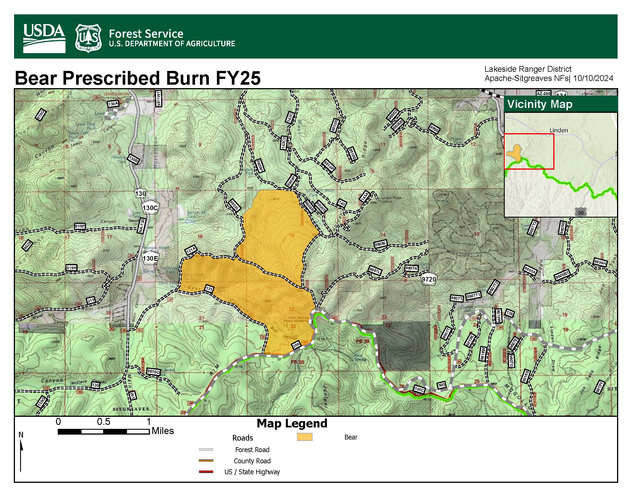
Fire managers plan to continue prescribed fire operations on the Lakeside Ranger District of the Apache-Sitgreaves National Forests beginning January 22 through February 7, 2025, as weather and vegetation conditions allow for successful operations. Implementation of the Bear burn unit was previously scheduled for the week of December 16, 2024, but was postponed due to the Forests’ response to the Horton Fire.
- The Bear burn unit is 973 acres and is 3 miles southwest of Linden, Arizona. The project unit is within Forest Road 300, Forest Road 131, Forest Road 131A, Forest Road 9809L, Forest Road 9809R, and Forest Road 143.
This landscape treatment is a cooperative effort with Arizona Game and Fish Department, Timber Mesa Fire Department, Arizona Department of Forestry and Fire Management, and Pinedale-Clay Springs Fire Department. The objective of this prescribed fire project is to reduce hazardous fuel accumulations, minimize the risk of high-severity wildfires, and return the landscape to a more fire-resistant condition, aligning with the Forest Service’s Wildfire Crisis Strategy. The Forest Service's 10-year Wildfire Crisis Strategy aims to reduce wildfire risk to people, communities, and natural resources while sustaining and restoring healthy, resilient fire-adapted forests.
Smoke may be visible from the City of Show Low, Pinetop-Lakeside, Communities of Pinedale, Clay Springs, Linden, Heber/Overgaard, Snowflake-Taylor and along Highways 60, 77 and 260. Smoke could last for several days after initial ignitions take place, but should be significantly less each day afterwards. We recognize that smoke can impact residents, visitors, and our fire personnel. We will continue to coordinate closely with our partners and communities to minimize smoke impacts as much as possible. The department’s Air Quality Division: Smoke Management webpage provides details about its air quality program. When smoke impacts are present, the Arizona Department of Environmental Quality recommends that smoke sensitive individuals should reduce physical activity and stay indoors with windows and doors closed. For those who are unable to avoid smoke exposure, use of a particulate-filtering respirator mask can help. Real-time mapping of smoke and other air quality impacts is available at fire.airnow.gov.
Visit the A-S National Forests website at https://www.fs.usda.gov/asnf and follow us on Facebook https://www.facebook.com/apachesitgreavesnfs.
