Flight restrictions removed as helicopters and UAS are released from the Horton Fire
Highlights: The Burned Area Emergency Response (BAER) continues to make assessments for post-fire risks. The temporary flight restriction (TFR) has been removed as the aircraft are released. Small Unmanned Aircraft Systems (UAS) are still being utilized on the incident; while there’s no TFR, pilots are encouraged to continue safe practices when flying over the fire area to protect crews that are still working throughout the fire area.
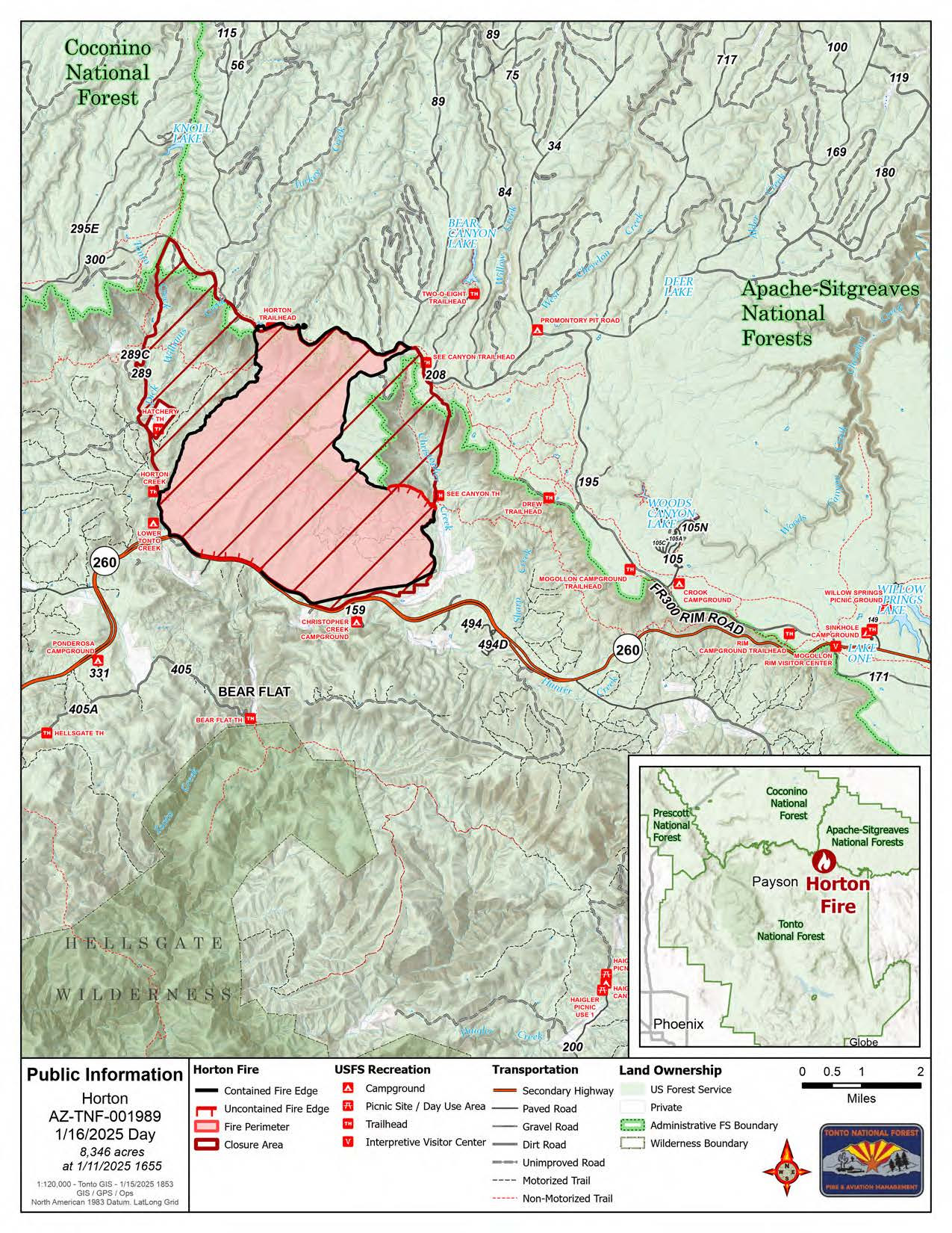
Operations: The SR-260 corridor is being monitored and patrolled, particularly in the area that remains uncontained. Crews will work on completing containment lines along the rest of the SR-260 corridor and travelers are encouraged to be cautious around firefighters and apparatuses on the road. Firefighters are patrolling the perimeter and working on suppression repair throughout all areas. Grading continues along the Forest Service 76 and 300 roads.
Weather: A warm and sunny morning is forecasted today with increasing cloud coverage as the day progresses. Winds will shift later in the day to south/southeast winds with gusts up to 20mph. There is a 30 percent chance of snow showers at higher elevations tonight.
Smoke: Smoke will continue to be visible as pockets of vegetation burn well within the interior of the fire footprint. For more information visit https://outlooks.wildlandfiresmoke.net/outlook/.
Forest Orders: As of January 13, 2025, the forest closure order was revised and reduced to reflect current conditions. Forest Order 03-12-00-25-02 is in place to protect public health and safety during the Horton Fire as well as protecting firefighting personnel engaging in wildland firefighting operations. To see the updates please visit: https://www.fs.usda.gov/alerts/tonto/alerts-notices.
Evacuations: On January 10, 2025, all communities returned to the READY evacuation status. The READY stage is continuous and involves preparing for all possible hazards before they strike. Creating “survivable space” around homes is one way to be READY against future wildfires. For more information on creating a fire wise home surrounded by survivable space please see: https://www.fs.usda.gov/about-agency/features/make-your-home-wildfire-defensible
Road Closures: For roadway status and conditions visit AZ Department of Transportation at https://www.az511.com/.
Fire details:
- Size: 8,346 acres
- Start date: December 14, 2024
- Cause: Under Investigation
- Location: Payson Ranger District, Arizona
- Containment: 89%
- Total personnel: 109
- Fuel: Timber, chaparral
- Resources: 1 crew, 5 engines, 1 bulldozer, 1 water tender
Information Links and Contacts:
- Phone Number: (602) 551-7327 (8 a.m. - 8 p.m.)
- Email: [email protected]
- Inciweb: https://inciweb.wildfire.gov/incident-information/aztnf-horton-fire-2024
- Facebook: https://www.facebook.com/TontoNationalForest
