Arizona Wildfire Response Dashboard

Arizona Emergency information Network Logo
Arizona Emergency information Network
  • Home
  • Emergency Bulletins
  • Hazards
    • Active Shooter
    • Bioterrorism
    • Chemical Emergencies
    • Cybersecurity
    • Drought
    • Dust Storms
    • Earthquakes
    • Extreme Heat
    • Flooding
    • Influenza
    • Landslides & Debris Flow
    • Nuclear Explosion
    • Palo Verde Generating Station
    • Power Outage
    • Space Weather
    • Radiological Dispersion Device
    • Thunderstorms
    • Tornadoes
    • Wildfire
    • Winter Weather
  • Get Prepared
    • Plan
    • Prepare
    • Inquire
    • Inspire
  • Resources
    • About AzEIN
    • Publications
    • ASL Glossary
  • Emergency Kit Cookoff
    • Recipes
    • Submit a Recipe

Main menu

  • Home
  • Emergency Bulletins
  • Hazards
    • Active Shooter
    • Bioterrorism
    • Chemical Emergencies
    • Cybersecurity
    • Drought
    • Dust Storms
    • Earthquakes
    • Extreme Heat
    • Flooding
    • Influenza
    • Landslides & Debris Flow
    • Nuclear Explosion
    • Palo Verde Generating Station
    • Power Outage
    • Space Weather
    • Radiological Dispersion Device
    • Thunderstorms
    • Tornadoes
    • Wildfire
    • Winter Weather
  • Get Prepared
    • Plan
    • Prepare
    • Inquire
    • Inspire
  • Resources
    • About AzEIN
    • Publications
    • ASL Glossary
  • Emergency Kit Cookoff

Sedona-area Miller Fire at roughly 19 acres; resources responding

5/24/2023 - 1:11 pm

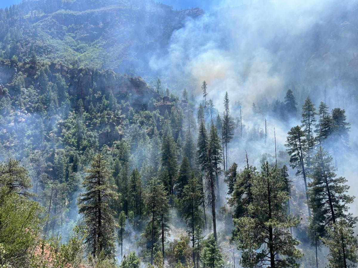
The Miller Fire, located in the Secret Mountain Wilderness of the Coconino National Forest’s Red Rock Ranger District (RRRD) (GPS coordinates: 34°57'21.2"N 111°50'05.6"W), is now at roughly 19 acres.

It is creeping and smoldering upslope and to the southwest toward the south side of Secret Canyon and Maroon Mountain at a low rate of spread.

Crews assigned to the fire include one Hotshot crew, two engines and two helicopters.

Resources successfully established a control line on the eastern side of the fire in Secret Canyon Tuesday, helping to stop the fire from spreading any further east.

Crews plan to spend today and the next several days working to hold control lines on the east side of the fire and work to suppress fire growth to the south. Rough and rocky terrain and steep cliff faces create challenges for on-the-ground fire suppression efforts.

The fire was first reported on May 20, but due to weather conditions, aerial resources were not able to confirm the fire until Monday, May 22. The cause of the fire is currently undetermined.

There are no structures threatened by the fire and smoke will remain visible.

The RRRD is working to implement trail closures for forest visitor safety, but until formal closure orders are issued, visitors are asked to avoid the fire area, including the Secret Mountain Loop Trails (Secret Canyon #121, David Miller #164, Bear Sign #59 and Dry Creek #52), the HS Canyon Trail #50 and Long Canyon Trail #122.

unnamed (6).jpg

Photo of trees with smoke blowing
Keywords: 
Coconino National Forest, Miller Fire, Secret Mountain Wilderness, Sedona, Red Rock Ranger District
Source: 
Coconino National Forest
Apache-Sitgreaves National Forests  Arizona Department of Environmental Quality  Coconino County  Coconino National Forest  Flagstaff  high pollution advisory  Kaibab National Forest  Maricopa County  ozone high pollution advisory  pile burn  prescribed burn  Prescribed Fire  Sedona  smoke  smoke impacts  Tonto National Forest  visible smoke  Wilbur Fire  winter weather  Yavapai County 

Tweets by AzEIN

Arizona State Seal
  • Contact Us
  • Statewide Web Policies

© 2019 Copyright AZEIN All Rights Reserved

  • Facebook
  • Twitter
  • Youtube
  • RSS